World Rainforest Day: How Drones Help Protect Rainforests
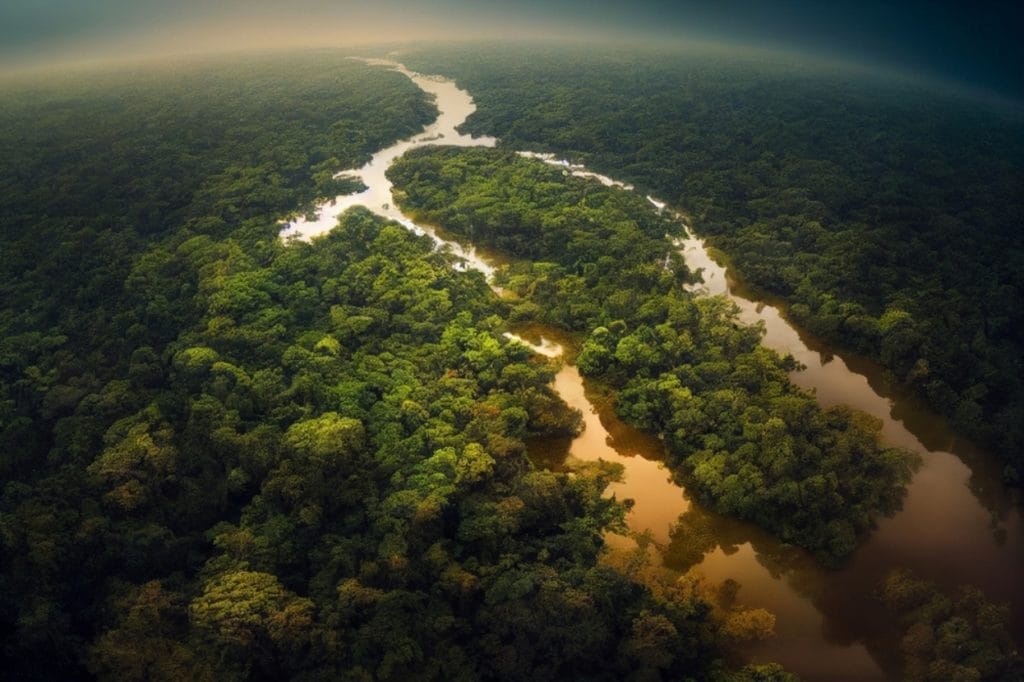
From the Amazon to Borneo, rainforests store carbon and help to regulate our weather. In recent years, drought and the growing prevalence of wildfires have threatened these delicate ecosystems. World Rainforest Day is a powerful way for us to remind ourselves that responses need to be faster than destruction.
Autonomous commercial drones offer that speed. Quiet, unmanned aircraft can scan tree crowns, transmit live alerts, and ferry supplies over rivers where roads fail. Affordable sorties are the perfect way to turn once-isolated reserves into strongholds of biodiversity.
Speed Matters
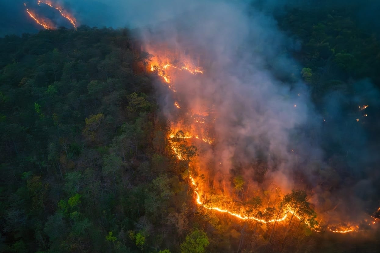
A flame the size of a candle can become an uncontrollable wildfire with alarming speed. Watchtowers are only able to see a small fraction of the canopy, and satellite images might land in an inbox days late.
Thermal-equipped drones are able to patrol fixed corridors and can record surface temperatures in centimetre detail. Then, algorithms can flag heat anomalies the moment they appear and then transmit coordinates and a thumbnail to the duty officer’s handset. Stopping these wildfires early saves money, habitats, and lives, too. The faster the report, the smaller the scar in the rainforest.
Drones Provide Everyday Protection
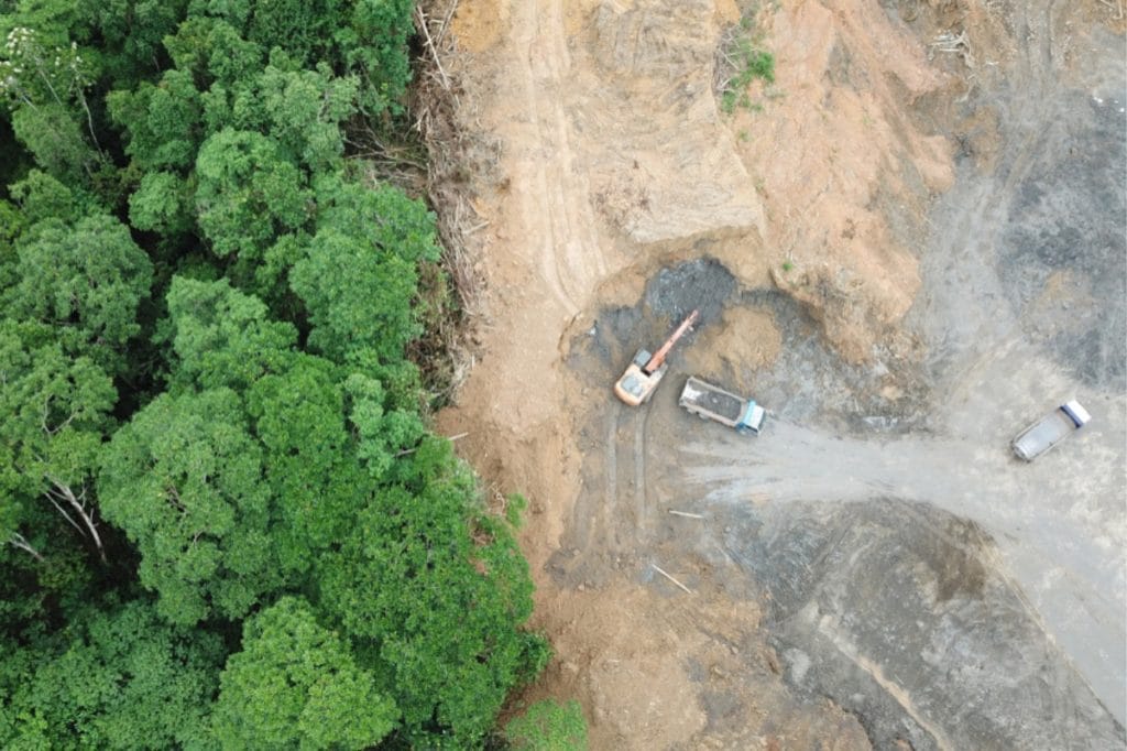
Illegal logging is still a persistent problem, especially in the Amazon. Destruction often starts quietly with an illegal track, and commercial drones carrying 61-megapixel cameras are able to create overlapping photographs that can be stitched into maps. Comparing consecutive flights reveals new clearings or stressed trees that human patrols would miss.
Flying below cloud cover gives us sharper images than many satellites; it’s also cheaper and safer than using crewed aircraft. These regular drone surveys can turn the forest into a living ledger. Flagging trouble early means that organisations can send small ground teams to intervene, sparing the wider ecosystems from further damage.
Real-Time Support During Wildfires
When fire does break through, drones can work as airborne command posts. Infra-red feeds give clear visualisation of flame fronts and embers drifting ahead of the line, and wind sensors provide warning if a gully is likely to funnel the blaze uphill.
Pilots are then well placed to overlay the video on maps to mark safe retreat routes and call in water drops with pinpoint accuracy. Cargo variants deliver pumps, hose couplings, and first-aid packs to crews stranded by fallen trees.
Because the flights are unmanned, no one risks flying low through smoke, and operations can also continue after dark under automated navigation lights. Infra-red readings also estimate flame temperature, guiding whether water or foam is best.
Guiding Restoration and Regeneration
Extinguishing flames is only the start. Multispectral sensors on drones read pigment, moisture, and chlorophyll. This means that they can highlight which pockets of the rainforest remain healthy and which suffer hidden root damage. The seed-dispersal drones can be programmed to drop biodegradable pods with native seeds, fungi, and slow-release nutrients exactly where they are needed.
Targeted planting is a powerful way to shorten recovery time and cut the fuel loads that feed future blazes. As a method, it’s also faster than hand planting and less disruptive than aerial spraying from crewed aircraft. The added precision from a drone-based approach supports self-sustaining ecosystems that lock in carbon and resist future wildfires.
Turning Raw Data into Smart Decisions
One single mapping sortie generates gigabytes of imagery and weather readings. Cloud processors, when deployed properly, can automatically stitch, classify, and tag this content. This means that managers can see clear reports marking young regrowth, veteran trees, and suspected disease outbreaks, for example.
Integrating drone outputs with rainfall gauges and river-level sensors can even help us build predictive models of fire or flood risk so teams can utilise the best possible resources before an emergency escalates. Because the pipeline from flight to insight is hours rather than months, frontline staff test a fire-break design one week and see verifiable results the next. Transparent metrics also help to make climate finance clearer and less intimidating to investors, as progress can be audited through timestamped drone imagery.
Windracers Makes These Mission Concepts a Reality
During recent trials with Lancashire Fire & Rescue, an autonomous Windracers ULTRA aircraft teamed with smaller drones to pinpoint controlled blazes and deliver 100 kg of fire retardant in a single drop. This is clear proof that an unmanned first response can be both swift and cost-effective. The same ULTRA swarm architecture – short-listed in the global XPRIZE Wildfire competition – lets multiple aircraft patrol thousands of square kilometres. It also uses onboard AI to flag heat signatures in real time and coordinate instant retardant releases while crews are still en route. We’re committed to treading lightly, too. Independent research on Orkney confirmed that ULTRA’s low-noise profile leaves sensitive seabird colonies undisturbed, so the platform can over-fly protected habitats without harming wildlife.
Want to Protect Ecosystems from Wildfires with ULTRA MKII?
At Windracers, we are dedicated to delivering essential goods and data where roads stop and forests begin. Our flagship ULTRA MKII autonomous aircraft carries up to 100 kg over 1,000 km, takes off from short dirt tracks, and needs no onboard pilot. That makes it the ideal partner for transporting water, tools or seed pods straight into dense forests or active wildfire zones, day or night. Click here to view the ULTRA MKII in action, browse our use cases, or get in touch with our team with any questions.
FAQs
How are conservation drones powered in remote areas?
Most carry swappable lithium-ion batteries. Field teams use portable solar chargers or small biofuel generators to top up packs between flights.
Do drones disturb wildlife during low passes?
When flown at sensible altitudes with quiet propellers, disturbance is minimal. Operators can also schedule flights outside peak nesting or feeding times to reduce any impact.
What certifications are required to operate drones over protected forests?
Rules tend to vary, but pilots typically need an unmanned aircraft licence plus special permission for beyond-visual-line-of-sight flights in conservation zones.

Further Reading
- University of Alaska Fairbanks purchases Windracers ULTRAs to test resupply delivery
- Windracers Unveils ULTRA MK2 in London
- NBC News Report: Startups race to build bigger, better drones to fight bigger, hotter wildfires
- Windracers Environmental Selected to Advance in the Prestigious XPRIZE Wildfire Competition